In this guide
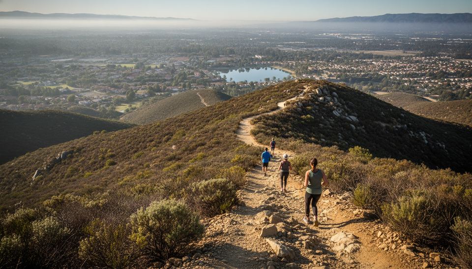
Cowles Mountain is the short, steep hike that half of San Diego seems to do before work. The summit reaches 1,593 feet (486 m), the highest point inside the City of San Diego, and it sits in Mission Trails Regional Park, a large open space run by the City of San Diego. From the top you look over Lake Murray, Mission Valley, the downtown skyline and, on clear days, the ocean and the mountains of East County.
The main route starts at Golfcrest Drive and Navajo Road in San Carlos and climbs on switchbacks to the summit. It is popular, rocky and almost completely exposed to the sun. Pick your trailhead and your hour well and it is a pleasant workout. Get them wrong and you will circle for parking, then climb in full sun. More hikes and coastal walks are in our Beaches & Outdoors section.
Cowles Mountain at a glance
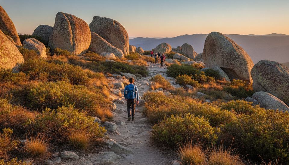
Trail guides put the main route at roughly a mile and a half each way. It gains close to a thousand feet, which makes it steeper than most city hikes. The surface is decomposed granite with rock steps and loose gravel in places. You do not need technical skills, but you do need decent shoes and some patience on the way down, when most slips happen.
There is no water and no shelter at the top. The summit has a benchmark, a few rocks to sit on and communication equipment on the far side. If you want more distance, a trail continues along the ridge toward Pyles Peak, a quieter neighbor summit.
Choosing a trailhead
Three access points are in common use. They all end on the same summit.
| Trailhead | Where | Parking | Character |
|---|---|---|---|
| Golfcrest and Navajo | San Carlos, corner of Golfcrest Drive and Navajo Road | Small free lot plus street parking | The main route, busiest, restrooms at the staging area |
| Barker Way | San Carlos, at the end of a residential street | Street parking only | Quieter, joins the service road, slightly longer |
| Santee side (Big Rock Park, Mesa Road) | Santee, north and east of the summit | Park lot or limited roadside spots | Longer approach, fewer people, more varied views |
Golfcrest Drive and Navajo Road
This is the trail most people mean when they say Cowles Mountain. The staging area has a small lot and restrooms, and the trail starts right behind it. Expect switchbacks the whole way and steady foot traffic in both directions. Keep to the right and let faster hikers pass.
Barker Way
The Barker Way route starts in a neighborhood southeast of the main trailhead. It climbs to the paved service road that winds up the mountain and meets the main trail near the top. Hiking guides describe it as only a little longer than the main route, with far fewer people. Since it starts on a residential street, keep your voice down early in the morning and park legally, away from driveways.
Santee side
From Santee, trails climb from Big Rock Park and from the end of Mesa Road. These routes are longer and see fewer hikers. They make sense if you live in Santee or want to link Cowles with Pyles Peak. Check a current Mission Trails map before you go, since some connector trails are informal and not all are signed.
Parking without the stress
The Golfcrest lot is small. On weekend mornings it can fill before the sun is fully up. When it is full, people park along Golfcrest Drive. Read the signs, watch for red curbs and do not block the bike lane or driveways. Parking is free at the main staging area.
Leave nothing visible in your car. Trailhead parking anywhere in the county is a target for break-ins, and an empty seat is your best deterrent. Take your phone and keys with you on the hike.
When to go
Time of day
Early morning is the classic choice, and for good reason. The air is cooler, the light is soft and the city is quiet below you. Sunset is the other favorite. If you go at sunset, plan the descent: dusk comes quickly, and the rocky steps are harder to read in fading light.
Midday in summer is the time to skip. The trail faces the sun most of the way, rock radiates heat back at you, and there is nowhere to cool off.
Season and weather
Winter and spring are the most comfortable. After rain, the hills turn green and the trail can be slick in places, so give it a day to dry. Summer and early fall bring heat in inland San Diego. The National Weather Service in San Diego issues heat advisories for the inland valleys; when one is out, pick another day or another hike.
Fall also brings Santa Ana wind events, with hot, very dry air and gusts on exposed ridges. Those days are poor ones for an exposed summit and come with higher fire danger. Our explainer on Santa Ana winds covers what they are and how to read the forecast.
Trail rules and etiquette
Mission Trails Regional Park allows leashed dogs. The City of San Diego trail map for the park states that dogs must be on a leash no longer than 8 feet and under the handler's control. Pick up after your dog and carry the bag out; there are no trash cans on the trail.
Stay on the main trail. Shortcutting switchbacks widens erosion gullies and loosens rocks onto hikers below. If your route uses the service road, remember that maintenance vehicles drive it, so stay alert there.
Music on a speaker is out of place on a crowded trail. If you need it, use headphones and keep one ear open for people coming down behind you.
Wildlife and plants
The slopes are covered in coastal sage scrub and chaparral, the native plant communities of inland San Diego. You may see lizards, hawks and ravens, and, especially in warm months, rattlesnakes. Rattlesnakes usually move away if you give them space. Watch where you put your hands and feet, keep dogs close, and do not try to move a snake off the trail. Wait, or step around it at a wide distance.
Making a morning of it
Cowles is short enough to pair with something else. Many hikers head down to Lake Murray for a flat walk afterward, or to the Mission Trails Visitor and Interpretive Center on Father Junipero Serra Trail, which has exhibits on the park's history and wildlife. Check the center's hours before you go.
If Cowles feels too crowded, the same habits apply on the coast. Our guide to the Torrey Pines hike covers a different kind of climb, with sea views and stricter reserve rules.
Quick answers on the trail
Is it hard? For a fit adult, it is a solid workout rather than a challenge. For a first hike, stop at the viewpoints to rest and take your time on the way down.
Is it good for kids? Older kids who like to climb usually enjoy it. Bring snacks and plan for the descent, when small legs get tired.
Can you see the ocean? On clear days, yes, far to the west. On a morning with low clouds, you may stand above a gray layer covering the coast, which is its own kind of view.
Match them up
Which Cowles Mountain trailhead fits?
Match each trailhead with what you will find there.
It's covered in the section Choosing a trailhead
Golfcrest Drive and Navajo Road : The main route, a small free lot and restrooms
Barker Way : Street parking and a quieter climb that joins the service road
Big Rock Park and Mesa Road : Longer approaches from Santee with fewer hikers
The ridge beyond the summit : A trail on toward Pyles Peak
Next up: Hot, dry wind in the forecast? Read our Santa Ana winds explainer before you plan an exposed hike.
Questions readers ask
How tall is Cowles Mountain?
The summit sits at 1,593 feet (486 m), which makes it the highest point within the City of San Diego.
Where is the main Cowles Mountain trailhead?
At the corner of Golfcrest Drive and Navajo Road in San Carlos, where Mission Trails Regional Park has a small parking lot and restrooms.
Can I bring my dog on Cowles Mountain?
Yes. Mission Trails rules require dogs to be on a leash no longer than 8 feet and under control, and you need to carry water for them since there is none on the trail.
When is the best time to hike Cowles Mountain?
Early morning on a cool day. The trail has almost no shade, the lot fills early on weekends, and hot or Santa Ana days are a poor choice.