In this guide
A Torrey Pines hike is short, scenic and more rule-bound than most San Diego trails. The reserve's paths run from a 100-yard staircase to a loop of about a mile and a quarter, so you can see the cliffs, the wind-bent pines and the ocean in an hour or two. The catch is timing: the upper reserve is closed for construction from September 22, 2026 into early 2027, and even in normal times the parking, the rules and the tide shape your day more than the distance does.
If you want the quick version: pick Guy Fleming for an easy loop with ocean views, Razor Point for the eroded badlands, or the Beach Trail if you want to end up on the sand. Bring water and nothing else to eat. Leave the dog at home.
Why Torrey Pines is different from other San Diego trails
Torrey Pines State Natural Reserve sits on the bluffs between La Jolla and Del Mar and protects the Torrey pine, a tree that grows wild only along this stretch of San Diego County coast and on Santa Rosa Island off Santa Barbara. Because it is a natural reserve rather than a regular park, California State Parks runs it with stricter rules aimed at protecting the soil and the trees.
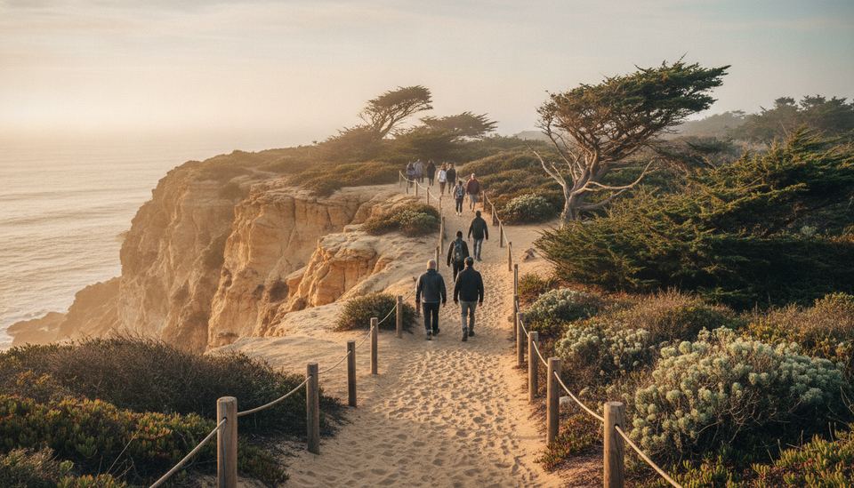
You'll feel that on the trail. Paths are fenced or lined with posts, shortcuts are off-limits, and the sandstone crumbles easily. That fragility is also what makes the place look the way it does: deep gullies, honey-colored cliffs and pines twisted by the wind.
For a broader look at the coast below, see our guide to San Diego beaches, and browse the rest of our Beaches & Outdoors section for other trails.
The trails at a glance
All distances below come from the official reserve trail map published by California State Parks. Distances are short, so you can combine two or three trails in one visit.
| Trail | Length (official map) | Effort | What you see |
|---|---|---|---|
| Guy Fleming Trail | 2/3-mile loop (about 1 km) | Easy, mostly flat | Ocean overlooks, pines, wildflowers in spring |
| Parry Grove Trail | 1/2-mile loop (0.8 km) | Moderate: 100+ rugged steps in and out | Quiet grove of Torrey pines |
| High Point | About 100 yards | Short and steep, with steps | View over the reserve, the lagoon and inland |
| Razor Point Trail | 1/2 mile to the overlook (0.8 km) | Easy to moderate | Gorges and badlands, ocean views |
| Beach Trail | About 3/4 mile one way (1.2 km) | Moderate, about 300 ft (90 m) of descent | Ends with stairs down to the beach |
| Broken Hill Trail | North Fork 1 1/4 mi, South Fork 1 1/3 mi one way | Moderate | Longest route, chaparral and cliff views, beach access |
Guy Fleming Trail
This is the one to choose if you have kids, older relatives or just one hour. The loop stays near the top of the bluff and has two ocean overlooks. In spring the edges fill with wildflowers. It's also the trail most likely to be busy, so arrive early.
Razor Point and the badlands
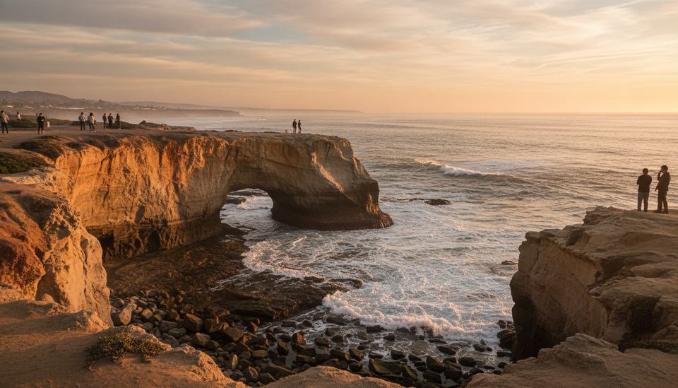
Razor Point heads toward the eroded ridges that photographers love. The overlook at the end looks down into gullies carved out of the sandstone. Stay behind the railings: the edges here are undercut and can give way.
Beach Trail and Broken Hill
These are the routes that drop toward the ocean. The Beach Trail descends roughly 300 feet (about 90 m) and finishes with a staircase onto the sand. Broken Hill is the longest trail in the reserve and also connects down toward the beach. Remember that what goes down must come back up, either by the same trail or by walking the beach and climbing the park road.
Parry Grove and High Point
Parry Grove is a small loop through a stand of pines, reached by more than a hundred uneven steps. High Point is barely a walk at all, but the short climb gives you a wide view over Los Peñasquitos Lagoon and inland. Both are easy add-ons to Guy Fleming.
Rules that catch first-time visitors
Most surprises at Torrey Pines come from the rules, not the terrain. According to the reserve's own website, torreypine.org, and the State Parks posted orders:
- No food or drink except water anywhere in the reserve, including the parking lots and paved roads. Picnics are allowed on the beach only.
- No dogs in the reserve or on the beach below. Working service animals are the exception; emotional support animals are not.
- No smoking, drones, alcohol, open flames or loud music.
- Stay on marked trails. Cutting switchbacks or climbing on the cliffs damages the sandstone and is dangerous.
- Day use only. The reserve opens in the morning and closes at sunset. There is no camping.
Some passes that work elsewhere in the state park system are not accepted here, so check the State Parks page before you count on one. Parking fees change, and this guide doesn't list them; the official page has current rates.
How to time your hike
Time of day
Arrive close to opening. The middle of the day, roughly 10 a.m. to 1 p.m., tends to be the busiest stretch, and the upper lot fills fast on weekends. Early mornings are cooler, and on overcast mornings you get soft light on the cliffs. In late spring and early summer, the marine layer can sit on the coast until midday, so the view may come and go.
Season
Spring is the reserve's best season for flowers. Summer brings heat on the exposed bluff, so carry more water than you think you need. Fall can be clear and warm, especially when dry offshore winds blow. Winter is the rainy season, and that matters here: State Parks generally closes the steeper trails, including Broken Hill, Razor Point and the Beach Trail, after rain to prevent erosion.
Tides
If you plan to walk the beach after the Beach Trail or Broken Hill, check a tide table first. At high tide the water reaches the base of the cliffs in places, and you don't want to be stuck under a crumbling bluff. NOAA publishes official tide predictions for the San Diego coast. Keep your distance from the cliff base even at low tide, since rock falls happen without warning.
Parking and getting there
The reserve sits off North Torrey Pines Road. When the upper reserve is open, there's a small lot near the Lodge at the top of the hill, which fills early. The larger North Beach and South Beach lots sit at sea level along the highway, and from there you walk up the park road, which adds a real climb before you even reach a trailhead. Plan for that extra effort if you park below.
Free roadside parking along the highway exists but goes quickly, and you'll walk along a busy road to get in. Whatever you choose, keep valuables out of sight in the car.
What to bring
- Water, more than you'd expect for a short walk, since the bluff has little shade.
- Sun protection: hat, sunscreen, sunglasses.
- Shoes with grip. Sandstone and sand on steps can be slick.
- A light layer for the morning marine layer and ocean breeze.
- A tide table if you're heading to the beach.
Leave snacks in the car or carry them sealed to eat on the sand. The Lodge, when open, has exhibits on the tree and the reserve's wildlife, plus restrooms.
A simple plan for a first visit
If it's your first time and the upper reserve is open, here's a route that fits in about two hours:
- Park early and stop briefly at the Lodge.
- Walk the Guy Fleming loop for the ocean overlooks.
- Climb High Point for the lagoon view.
- Head out along Razor Point to the overlook.
- If the tide is low and your legs are fresh, take the Beach Trail down and decide whether to climb back the same way.
If you're in town for a day of exploring and want something less strenuous after the hike, Balboa Park is a good afternoon counterpart.
Put it in order
Shortest to longest: Torrey Pines trails
Put these four reserve trails in order, from the shortest walk to the longest, using the official map distances.
- Guy Fleming Trail (2/3-mile loop)
- High Point (about 100 yards)
- Beach Trail (about 3/4 mile one way)
- Broken Hill Trail, North Fork (1 1/4 miles one way)
It's covered in the section The trails at a glance
- High Point (about 100 yards)
- Guy Fleming Trail (2/3-mile loop)
- Beach Trail (about 3/4 mile one way)
- Broken Hill Trail, North Fork (1 1/4 miles one way)
Next up: Planning the rest of your day? See how to visit Balboa Park without missing the best parts.
Questions readers ask
How long is the Torrey Pines hike?
Most trails are under a mile. Guy Fleming is a 2/3-mile loop, Parry Grove a half-mile loop, the Beach Trail about 3/4 mile one way, and Broken Hill, the longest, roughly 1 1/4 to 1 1/3 miles one way, according to the official reserve map.
Can I bring my dog to Torrey Pines?
No. Dogs are not allowed in the reserve or on the beach below it. Working service animals are the exception.
Can I eat on the trails at Torrey Pines?
No food or drink other than water is allowed anywhere in the reserve, including the parking lots and roads. Picnics are permitted on the beach only.
Is Torrey Pines open right now?
California State Parks closed the park road, upper lots, trails and the Lodge on September 22, 2026 for construction, with full access expected by March 1, 2027. Torrey Pines State Beach and its lower lots stay open. Check the State Parks page before you go.
What is the best time to hike Torrey Pines?
Early morning on a weekday, shortly after opening. Late morning to early afternoon is usually the busiest stretch, and the steep trails are closed after rain.