In this guide
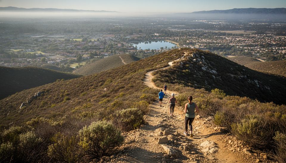
Potato Chip Rock is a thin, overhanging flake of granite near the top of Mt. Woodson, in the hills between Poway and Ramona. To reach it, most people hike the Mt. Woodson Trail up from Lake Poway, which is a long, steep, mostly shadeless climb. A shorter approach follows a paved service road up from State Route 67 on the Ramona side.
Either way, you end up on a boulder-covered summit with antennas, wide views of inland North County, and usually a line of people waiting to stand on the chip for a photo. This guide covers both routes, parking, the heat rules, and what to expect at the top. For other trails around the county, browse our Beaches & Outdoors section.
What Potato Chip Rock Actually Is
The "chip" is a slab of granite a few inches thick that sticks out from a larger boulder, high above the slope below. From the right angle, it looks like you're standing on a potato chip hanging over open air. In reality, the drop right under it is much smaller than the photos suggest. The camera angle does most of the work.
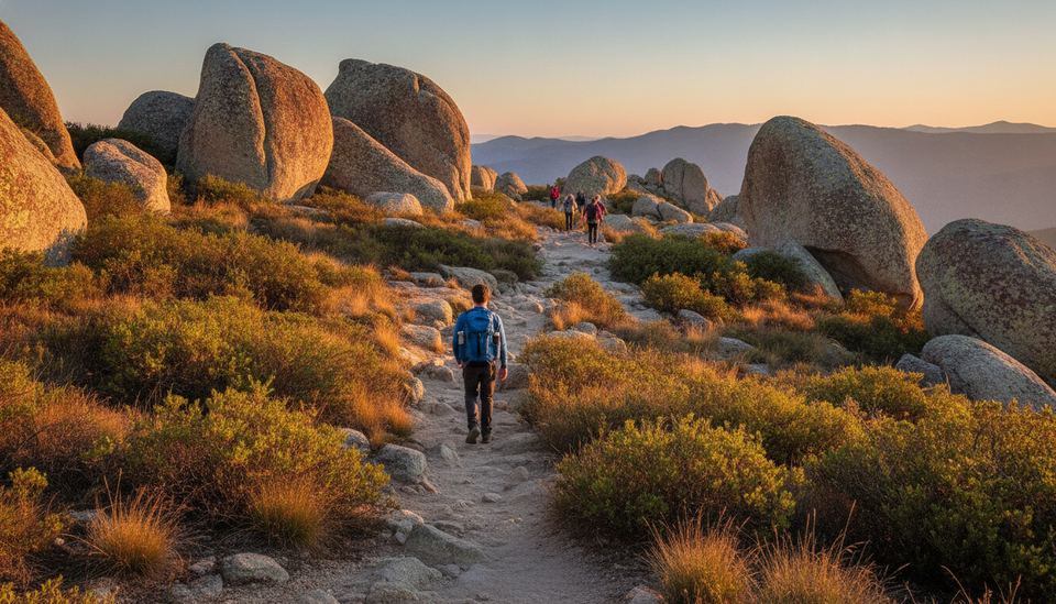
Mt. Woodson itself is a granite peak covered in chaparral and huge rounded boulders. The rock is a short scramble below the summit, where the communication towers stand.
The Two Main Routes
From Lake Poway (the Classic Route)
This is the route most people mean when they say "the Potato Chip Rock hike." You park at Lake Poway, walk around part of the lake, then climb the Mt. Woodson Trail through a long series of switchbacks to the summit ridge.
Published route descriptions don't agree on the exact distance, because they start measuring at different places. Most put the round trip somewhere between about 6.5 and 8 miles, with roughly 2,000 feet of climbing. Treat it as a half-day hike, not a quick after-work walk. Restrooms are at Lake Poway, and that's the last chance you'll have.
From Highway 67 (the Shorter, Steeper Route)
On the east side of the mountain, a paved service road climbs to the towers from State Route 67. It is shorter than the Lake Poway route but steep the whole way, with no switchbacks to ease the grade. People often call it the "back way." The pavement is easy to follow, and there's even less shade than on the west side.
Parking for this side is along the highway shoulder or, as an alternative, at San Diego County's Mt. Woodson Gateway preserve, which sells day-use parking passes online. Highway 67 traffic moves fast, so park only where it's clearly allowed and walk well off the pavement.
Which Route to Choose
| Lake Poway route | Highway 67 route | |
|---|---|---|
| Surface | Dirt trail, rocky in places | Paved service road |
| Length | Longer, roughly 6.5 to 8 miles round trip in published descriptions | Shorter |
| Grade | Steady climb with switchbacks | Steep and relentless |
| Shade | Very little | Almost none |
| Restrooms | At Lake Poway | None |
| Parking | Lake Poway lot (fee for non-residents on weekends and holidays) | Highway shoulder or County Gateway lot (paid online pass) |
If you want the classic trail experience and you're fit, start at Lake Poway. If you're short on time and don't mind a hard, steady grind on pavement, take the Highway 67 side.
Parking at Lake Poway
Lake Poway is a City of Poway park. According to the City of Poway, the entry station collects a parking fee from non-residents on weekends and holidays, while Poway residents with proof of residency park free. On weekdays, parking is generally free. The lot fills on nice weekend mornings, so arrive early. The city's page lists the current fee and hours, which run from early morning until shortly before sunset.
Heat, Water and Timing
The Heat Is the Real Danger
Mt. Woodson is inland, south-facing for much of the climb, and covered in rock that holds heat. In summer and early fall, temperatures on the trail can climb well above what you'd expect after a cool morning at the beach.
The City of Poway has closed the Mt. Woodson and Iron Mountain trails during past heat waves, when temperatures were expected to reach about 100 degrees with a heat advisory in effect. Closures were posted on signs at the trailheads and announced by the city. Before you go, check the National Weather Service San Diego forecast for Poway and Ramona, and look for any city notice.
Hot, dry Santa Ana days in fall are another reason to rethink a summit hike. Our guide to Santa Ana winds explains how those conditions build.
Bring More Water Than You Think
There is no water on the trail. Trail guides recommend carrying enough for the whole round trip, plus extra for a dog if you bring one. Salty snacks help on a long climb. If you run low before the top, turn around; the rock will still be there next weekend.
Best Time to Go
Cooler months, roughly late fall through spring, are the most comfortable. On any day, start early. A sunrise start gets you up and down before the worst heat, and you'll find a shorter line at the rock. The marine layer sometimes covers the lowlands in the morning, which can make the summit feel like it's floating above the clouds.
At the Top: The Photo Line and Staying Safe
How the Line Works
On weekends, expect a line of hikers waiting to step onto the chip. It's informal: people take turns, and often someone in the next group offers to take your photo while you take theirs. Be patient and quick. Have your camera settings ready before it's your turn.
Getting on the Rock Safely
You reach the flake by stepping or hopping across from the boulder behind it. Take it slowly. Granite is grippy when dry but slick with dust, and the step is easier going out than coming back.
A few common-sense rules:
- Don't jump or bounce on the slab. It's a natural formation, not a platform, and nobody inspects it.
- Keep one group on the rock at a time.
- Skip it if the rock is wet or the wind is strong.
- Keep kids close on the boulders around the summit, where the gaps between rocks are deeper than they look.
The Summit Itself
The actual summit is a short scramble past the rock, among the towers. The view takes in Lake Poway, Ramona, and on clear days the mountains to the east. It's a good place to rest and drink before heading down.
Hiking With Dogs and Kids
Trail guides list Mt. Woodson as open to leashed dogs. Check posted signs at the trailhead for current rules. Think hard about the heat before bringing a dog: the dirt and rock get hot enough to hurt paws, and there's no water on the way.
For kids, the Lake Poway route is long and the descent is hard on tired legs. A child who handles a few miles on flat ground may struggle here. If you want a shorter summit with similar views first, our guide to Cowles Mountain covers a closer peak in Mission Trails. Coastal families might also try the bluff-top trails at Torrey Pines, where the ocean keeps things cooler.
Getting Down
Going down takes almost as long as going up, and it's where most slips happen. Loose gravel on the Lake Poway trail rolls under your shoes on the steeper switchbacks. Shorten your stride, look where you place your feet, and use trekking poles if you have them. On the Highway 67 road, the steep pavement is hard on knees, so take it in short, controlled steps.
Leave the trail as you found it. Pack out all trash, including fruit peels, and stay on the main trail rather than cutting switchbacks, which erodes the slope.
Your checklist
Potato Chip Rock: your pre-hike checklist
Check off each item as you get ready. Your progress is saved on this device only.
Questions readers ask
How long is the Potato Chip Rock hike?
From Lake Poway, published route descriptions put the round trip at roughly 6.5 to 8 miles with around 2,000 feet of climbing, depending on where they start measuring. The Highway 67 approach is shorter but steep.
Do you have to pay to park for Potato Chip Rock?
At Lake Poway, the City of Poway charges a parking fee to non-residents on weekends and holidays; Poway residents with proof of residency park free. San Diego County's Mt. Woodson Gateway lot has a paid day-use pass sold online. Check both pages for current rates.
Is Potato Chip Rock open in summer?
Usually, but the City of Poway has closed the Mt. Woodson and Iron Mountain trails when temperatures near 100 degrees and a heat advisory is in effect. Check the city's notices and the National Weather Service forecast before you go.
Is there water on the Mt. Woodson trail?
No. There is no water on the trail and very little shade, so carry all the water you need for yourself and any dog with you.